ESRI Presents ArcGIS Solutions to Fort Bend GIS Consortium

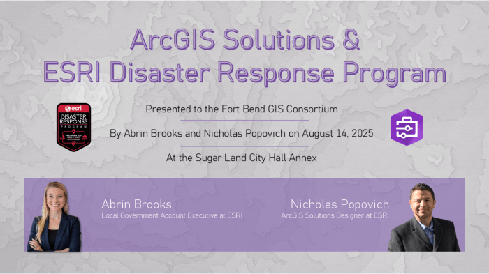
Sugar Land City Hall Annex, August 14, 2025 – Mrs. Abrin Brooks and Mr. Nicholas Popovich presented as representatives of ESRI on the ArcGIS Solutions platform and the ESRI Disaster Response Program to members of the Fort Bend GIS Consortium (FBGISC). ArcGIS Solutions are a collection of free, industry-specific configurations of ArcGIS that can be deployed by an organization to improve operations and enhance services. These solutions use an organization’s authoritative data and can be used as is or customized to fit unique needs. They range in scope from a single ArcGIS Pro project to a series of integrated ArcGIS applications and are included with ArcGIS, deployable in an ArcGIS Online organization or an ArcGIS Enterprise portal.

To set the tone for this workshop, Mrs. Brooks communicated that ArcGIS Solutions is included with all members base small local government service contracts with ESRI. This clarified that the technology showcased during the workshop was for currently accessible and not a sales demonstration for members.

ArcGIS Solutions are designed as ready-to-go templates with customization features, similar to ArcGIS Instant Apps. Searchable templates from both official and user sources are available to serve as both an immediate solution and design ideas for your organizational needs. Mrs. Brooks and Ms. Anna Gonzalez provide support to our local public entities while Mr. Popovich works on development directly related to ArcGIS Solutions.

Mr. Popovich provided a live-walkthrough demonstration of the ‘GIS Request Management’ solution he developed for ESRI. This solution serves as a ticketing system, technology use, and departmental activity metrics. In addition to operational benefits, the solution adds a layer of transparency to your GIS department’s operations by documenting and archiving past, ongoing, and planned activities. It was also noted that nearly all FBGISC member organizations are actively using this solution to some degree already. Given the solutions integration-friendly design with other ticketing platforms from major vendors, this solution offers a seamless option to better service clients and track projects, serving as a ready-made framework for advanced solutions beyond the out-of-box offerings.

In addition to the official ESRI solutions, ESRI has also provided video-introductions and help-documentation for their templates and include create all ESRI templates so that they are compatible with base contracts, without additional costs attached.

In summary, Mr. Popovich highlighted the ‘GIS Request Management’ solution as a tool for submitting and tracking work requests, that additionally provides metrics and logs for internal monitoring. The solution offers levels of access, such as team / manager / program to ensure the right people have the right access, keeping the solution focused on desired intents, whether those are tracking progress, reaching department goals, or monitoring program time & effort metrics. Lastly, community data sharing with Apple Maps and TomTom improve location based access and ticket tracking. ESRI is working on expanding this location collaboration to Google Maps as well.

Following the ArcGIS Solutions workshop, Mrs. Brooks gave a brief overview of ESRI’s Disaster Response Program (DRP). The Esri Disaster Response Program (DRP) is a corporate citizenship initiative that provides GIS support to organizations worldwide during crises. The program, which has been active for over 25 years, offers 24/7 assistance, including software, data, configurable applications, and technical support. Its goal is to help organizations improve situational awareness, make better decisions, and respond more effectively to a wide range of disasters, such as earthquakes, floods, and wildfires, as well as public health crises. The DRP has provided assistance during notable events like the COVID-19 pandemic and Hurricane Katrina.

This program was notably used by the City of Sugar Land in response to Hurricane Beryl, allowing the City’s first-responders and Office of Emergency Management to respond with a complete geospatial toolkit at the ready, without the need to purchase of additional licenses and backed up with additional support directly from ESRI.

LJA Engineering presents to Fort Bend GIS Consortium

City of Sugar Land Regional Airport, May 15, 2025 – Mr. George Culver, Director of GIS at LJA Engineering (LJA) and the Industry Liaison to the Fort Bend GIS Consortium (FBGISC) presented to members and greater area partners on the leverage of GIS by LJA as the employee-owned company grew from 40 to over 2,000 employees over LJA’s 50+ years of business. Emphasizing LJA’s unofficial motto of Grow or Die, Mr. Culver guided attendees through the adoption and growth of GIS across every department and operation within LJA. Beginning with the all too familiar task of layering parcels over imagery, to the use of automated data processes, to the integration of company-wide communications into project packets complete with land history, parcel data, land development prospects, and existing trails of correspondence, LJA has not only leveraged existing GIS solutions available on the market, but pushed past the boundaries of what is available and supported the development of their own internal geospatial solutions and infrastructure.

Beyond their services, LJA invests into the next generation of engineers through internship opportunities and graduate programs. You can learn more about internship and early career programs here.

So, what did this presentation offer a consortium of public entities? It gave insight and example to how publicly sourced geospatial data is utilized in the private industry, and the potential for cost-savings that being proper data-stewards offers the public. The public investment in geospatial technologies offers similar return-on-investments as it has for LJA. While we, public entities, are not profit motivated, we are charged with leveraging existing and future resources to optimize operations that are critical to the public-at-large. From supporting disaster preparedness and response to simplifying animal-control operations, a small investment in public geospatial technologies can yield returns far beyond the initial cost and improve the lives of our residents.

The National Map – USGS presents to FBGISC

City of Sugar Land – Council Chambers, February 13, 2025 – Ms. Michelle Fischer, National Map Liaison for AR, LA, OK, & TX at the U.S. Geological Survey (USGS) presented to the Fort Bend GIS Consortium on the wide variety of topographic information available through USGS’ National Map. Beyond the data itself, members were briefed on the National Geospatial Program and their four As; Authoritative, Accessible, Available, Accurate. Ms. Fischer informed us of both the specifications at which different data are collected as well as the efforts USGS goes through to promote public partnerships that both increase the coverage of their data and reduce the fiscal burden of data collection projects through cost-sharing and reductions of duplicated efforts among public entities.

The Geospatial Information Response Team (GIRT) was also introduced to members. Presenting on the heels of a major ice event with another on the horizon, GIRT provided our public members with an additional tool when responding to natural disasters in our local Fort Bend area jurisdictions, improving our capability to serve our citizens in times of need.

At the heart of the presentation, were the topographic products and services offered publicly through the National Map. The products and services offer a free and accessible source of data for local Fort Bend jurisdictions to utilize in pre-planning and site study projects, potentially offsetting local data-collection costs through the use of their high-resolution topographic data.

To learn more about the USGS and The National Map, you can view the presentation slides by clicking here.

City of Sugar Land Emergency Management & GIS

City of Sugar Land – Cane Room, August 20, 2024 – Ms. Caroline Egan, Assistant Emergency Management Coordinator of the City of Sugar Land (COSL), presented to the Fort Bend GIS Consortium and lead a round table discussion on emergency management planning and response. Members were lead through “blue skies1” preparation phases, the unique roles of GIS (as a tool and a group) during a “grey skies2” event phase, and a case study related to Hurricane Beryl. Additionally, Ms. Egan showcased several COSL dashboards and introduced members to their ‘Link Tree3‘. Ms. Egan’s presentation, coupled with her vast experience, engaged members and encouraged meaningful discussions that improved understanding and approach tactics to our members internal emergency management plans. The presentation can be viewed by clicking here.

  1. “Blue sky” refers to non-disaster periods. General emergency management activities include preparedness initiatives such as writing and exercising plans, educating the community about disasters, and engaging in mitigation actions that reduce a disasters impact on people and property. (source)
  2. “Grey sky” refers to the period immediately before, during and after an incident has occurred. It includes a response phase where priorities are protecting lives and property. It also encompasses recovery actions that begin once the incident is stabilized to rebuild the community. (source)
  3. A “Link Tree” refers to a specific type of tool or service that allows individuals to create a landing page containing multiple links. The purpose of a link tree is to provide a convenient way to share various links with an audience.

It Takes a City! -Insights into Open Portal at the City of Sugar Land, TX

Fort Bend Chamber of Commerce, April 25, 2024 – Ms. Miriam Salazar of the City of Sugar Land (COSL) and the Vice Chairperson of the Fort Bend GIS Consortium (FBGISC) presented to members at out Q2 meeting on the Open Portal project by the City of Sugar Land. The presentation, which demonstrated the technology’s front and back-ends, provided insights into the planning, development, and implementation efforts that spanned nearly every department of the City of Sugar Land. These insights provided critical details to other local government representatives considering similar open portal efforts and encouraged in depth discussions among members. These kinds of presentations successfully targeted one of the core goals of FBGISC: collaboration between local government GIS offices.